India- Nepal- China: Delicate Balancing Act
June 13, 2020 | Expert Insights
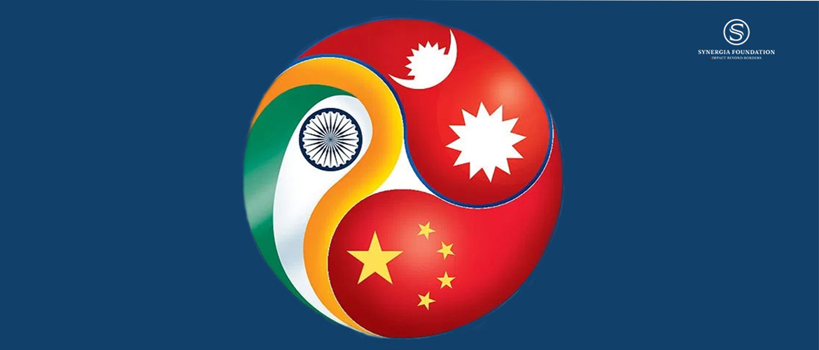
The Kalapani region is an approximately 370 sq.km-wedge of disputed territory along the eastern boundary of Uttarakhand with the Tibet Autonomous Region of China, which includes the tri-junction between India, China and Nepal. Under Indian control for the last 200 years, this piece of real estate traces its history to the Anglo-Nepalese war of 1814-15 when East India Company forces under Sir David Ochterlony recaptured Garhwal and Kumaon from Gurkha forces. Under the treaty of Sugauli signed in 1816, the river Mahakali marked the western border of Nepal.
Unfortunately, Mahakali is a fickle river with a confusing origin and indistinguishable alignment, frequently changing course. Even its origin is in dispute, thus creating the controversy whether the wedge of land encompassing Kalapani-Limpiyadhura-Lipulekh pass is in India or Nepal. Nepal claims the source of Mahakali as the Lipu Gad arising at Limpiyadhura, and then traces the borderline along its course to buttress its claim. India points out that Lipu Gad is “one of the many tributaries”, but is not the Mahakali per se. India cites the river Pankhagad as the origin of the Mahakali. It further quotes revenue records stretching back to late 1800s showing the area under the administrative control of Pithoragarh district. The Indo Tibetan Border Police have been manning posts in the region for decades, and the Indian Army regularly patrols the region.
India and Nepal have mutually settled 98% of their 1,850-km-long boundary through a Joint Technical Level Boundary Committee set up in 1981, less Kalapani, Lipulekh and Limpiyadhura.
Why Tensions Now?
In November 2019, as a consequence of the abrogation of Article 370 in J&K, India published official maps showing the new Union Territories. Inclusion of Kalapani as part of Uttarakhand in these Indian maps did not escape the notice of Nepal, opening old wounds. The K.P. Sharma Oli-led government lodged a formal protest. Nepal also published its own set of maps showing the disputed area of Kalapani within its own sovereign territory. Further, it has also staked a claim on a stretch of land in Susta, in Gorakhpur district of Uttar Pradesh, bordering Nepal's terai region.
As part of its strategic infrastructure drive opposite the entire stretch of the India-China border, India recently organised a high-profile inauguration of an 80-km road connecting the strategic border town of Dharchula to the Lipulekh pass. This is also a traditional pilgrimage route to Kailash-Mansarovar, which was undertaken on foot up to Lipulekh pass. This road traverses over the disputed area of Kalapani.
On June 9, 2020, the Nepal House of Representatives passed a constitutional amendment to make the new map the official political map of Nepal. Hence, the die was cast, with any concessions being made by either side rendered politically improbable.
India and Nepal, though bonded historically through religion, culture, and economic dependence, have experienced strains in relationship since the 2015 two-month-long trade blockade imposed by India. The memory of this embargo remains a nagging issue with anti-India forces in Nepalese polity, who tend to raise it at the first opportunity. Furthermore, a perception has gained traction in Nepal accusing India of putting BIMSTEC (The Bay of Bengal Initiative for Multi-Sectoral Technical and Economic Cooperation) and BBIN (Bangladesh-Bhutan-India-Nepal) in cold storage in retaliation to Nepal joining the Chinese Belt and Road Initiative (BRI).
Nepalese political parties have always used the 'Indian Card' as a diversion to own political failings. There is a huge groundswell of goodwill for India, with a huge segment seeking jobs in India. However, domestic, political, and geostrategic compulsions often surpass the economic benefits accruing from this relationship.
ENTER THE DRAGON
Post the blockade and the 2015 Nepal earthquake, China, although always a significant presence in Nepal, grew even bolder. There was a massive flow of investments. By 2019, Nepal had accepted nine major projects under BRI, which included the strategic Kathmandu-Kyerung railway, university projects, power transmission lines, and a network of roads connecting Nepal to Tibet.
Indo-Nepal trade in 2018 stood at $6.82 billion, but is largely in India’s favour as Indian exports are $6.38 billion. China is fast overtaking India with the railway connectivity itself estimated to cost over $8 billion.
Indian and Nepalese media have been full of commentaries on the alleged Chinese interference in the political affairs of Nepal. China has provided unstinted support to the Nepalese communists and was instrumental in its new avatar, the New Communist Party (NCP). When there was a rift in the ruling NCP threatening its parliamentary majority, apparently, discreet messaging from Beijing settled the issue.
WHAT IS MUDDYING THE KALAPANI WATERS
The Kalapani dispute goes beyond a historical difference of perception of border alignment. Its timing, in concert with Chinese moves in Ladakh, is of concern to India. It was a rare coincidence that on May 9, when intrusions were taking place in Eastern Ladakh, there was an official Nepalese statement, in response to the new road, asking India to “refrain from carrying out activity inside the territory of Nepal”.
This hints at a strategic collusion against India, along with China and Pakistan. Not surprisingly, the India Army chief made a statement stating that Nepalese protests to the Kalapani road were “at the behest of someone else”.
India is extending its strategic reach through an extensive border road construction programme, which after lagging for decades, is finally fructifying in many sectors. This, along with the Indian strategic partnership with U.S., and possibly with Australia and Japan subsequently, ring alarm bells at higher political echelons of Beijing.
Lipulekh Pass, located at the tri-junction of India-Nepal-China, is a strategic vantage point for India to monitor activities in Tibet. In purely military terms, a good road always creates a window of opportunity for "quid pro quo options” in retaliation to any Chinese salami-slicing action.
Assessment
This is not the time for India to open multiple diplomatic/military stand-offs across its frontiers. Border disputes can be settled through peaceful consultations and a spirit of give and take. Indian support to Nepal to combat COVID-19 has been significant, which has been publicly acknowledged by Nepal at the highest level. Perhaps, now is the time for a greater soft power approach by India towards its smaller neighbours, despite the hawks calling for punitive actions.
Geography favours India and despite rail and road connectivity with China, trade and access to seas have to flow through India. In the long term, Nepal and India will have to look at a shared destiny which cannot be achieved through confrontation.
India cannot match China's deep pockets in doling out mega infra projects to please Nepal. In fact, the tardy progress of some of the Indian projects in Nepal has only dented India's credibility and raised the stock of China. As a responsible regional power, India must take the first step to resolve the border dispute through joint dispute resolution mechanisms rather than giving space to third parties to step in.
Author: Maj. Gen. Ajay sah, Chief Information Officer Synergia Foundation



Comments