Hurricane Florence makes landfall in North Carolina
September 15, 2018 | Expert Insights
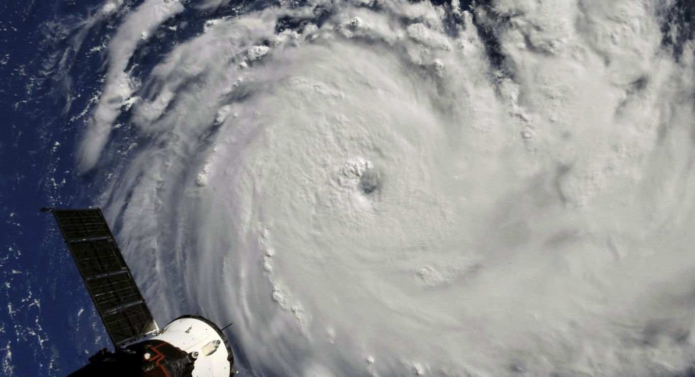
The powerful hurricane hit parts of North Carolina on Friday, pushing a life-threatening storm, surge of floodwater, and heavy rains.
Background
When the maximum sustained winds of a tropical storm reach 74 miles per hour, it is called a hurricane. Hurricane Season begins on June 1 and ends on November 30, but these powerful storms can occur before and after the official season. A hurricane can be an awesome and destructive force of nature.
Hurricanes originate in the Atlantic basin, which includes the Atlantic Ocean, Caribbean Sea, and Gulf of Mexico, the eastern North Pacific Ocean, and, less frequently, the central North Pacific Ocean. A six-year rotating list of names, updated and maintained by the World Meteorological Organization, is used to identify these storms.
A tropical cyclone is a rotating low-pressure weather system that has organized thunderstorms but no fronts (a boundary separating two air masses of different densities). Tropical cyclones with maximum sustained surface winds of less than 39 miles per hour (mph) are called tropical depressions. Those with maximum sustained winds of 39 mph or higher are called tropical storms.
Analysis
Florence made landfall as a Category 1 hurricane a few miles east of Wilmington as the center of its eye, moved onshore near Wrightsville Beach, the National Hurricane Center said.
Coastal streets flowed with frothy ocean water and tens of thousands of residents lost electricity. Forecasters said “catastrophic” freshwater flooding was expected along waterways far from the coast of the Carolinas. At 7 a.m., Florence was centered just 5 miles (10 kilometers) east of Wilmington, North Carolina. Its forward movement was 6 mph (9 kph). Hurricane-force winds extended 90 miles (150 kilometers) from its center, and tropical-storm-force winds up to 195 miles (315 kilometers).
Strong winds bent trees toward the ground and raindrops flew sideways as Florence moved in for an extended stay, with enough of its powerful winds swirling overseas to maintain its power. Forecasters said the onslaught could last for days, leaving a wide area underwater from both heavy downpours and rising seas.
A weather station at a community college recorded a 100 mph wind gust, and forecasters tweeted that a 91 mph wind gust slammed into Wilmington’s airport, surpassing the power of Hurricane Fran two decades ago. The National Hurricane Center said a gauge in Emerald Isle, North Carolina, reported 6.3 feet (1.92 meters) of inundation. Emerald Isle is about 84 miles 135 kilometers) north of Wilmington.
About 46 miles further up the waterfront, in New Bern, about 150 people were waiting to be rescued from floods on the Neuse River, WXII-TV reported. The city said two FEMA teams were working on swift-water rescues and more were on the way. The worst of the storm’s fury had yet to reach coastal South Carolina, where emergency managers said people could still leave flood-prone areas.
Forecasters said conditions will continue to deteriorate as the storm makes its way slowly inland. Its surge could cover almost all of the Carolina coast under as much as 11 feet (3.4 meters) of ocean water, and days of downpours could unload more than 3 feet (0.9 meters) of rain, triggering a severe flood.
Once a Category 4 hurricane with winds of 140 mph (225 kph), the hurricane was downgraded to a Category 1 on Thursday night.
Assessment
Our assessment is that Hurricane Florence will not be as strong as Hurricane Irma or last year’s Hurricane Maria but can still cause significant economic damage to North and South Carolina. We believe that the slowing down of the hurricane will be beneficial for the Eastern coast of the US, as there are lesser chances of violent thunder storms. However, we also feel that flooding remains as the biggest threat and Hurricane Florence will cause heavy rainfall for the next two days.


Comments